Ash nazg durbatulûk
Ash nazg gimbatul
Ash nazg thrakatulûk
Agh burzum-ishi krimpatul.
So it is written on the One Ring in J.R.R. Tolkien's Lord of the Rings trilogy, words in the Black Speech that only become visible when flames lick against it. Tolkien had somewhat of a fascination with Iceland, and had studied everything from Old Norse to Modern Icelandic. At age 16 he started translating Völsungasaga, which contained many of the archetypes that would enter his series, such as a cursed gold ring, a dragon sleeping on a golden horde, a broken sword to be reforged, and many others. He would later, as a student, publish a paper on it. He taught a linguistics course that included in Icelandic in 1920. He formed a student Viking Club. He lobbied to replace part of the education on Shakespeare with coursework on the Icelandic sagas. Later in life but before his writing career, he hired an Icelandic au pair to help him practice his Icelandic, and listened in while she told his children traditional Icelandic stories of elves, trolls, and other beings. Tolkien took his dwarf names straight from the Poetic Edda. While the Shire is based on England, his "Hobbit Holes" are based on traditional Icelandic torfbær homes. The scenery described on Bilbo's ride to Rivendell is almost directly taken from William Morris's icelandic travel journals, which Tolkien had read.
And yes... we have our own variant of Mordor, too. Which is, as always, the subject of tonight's Eldfjallavakt.
More toxic gases and glowing rock below the fold!
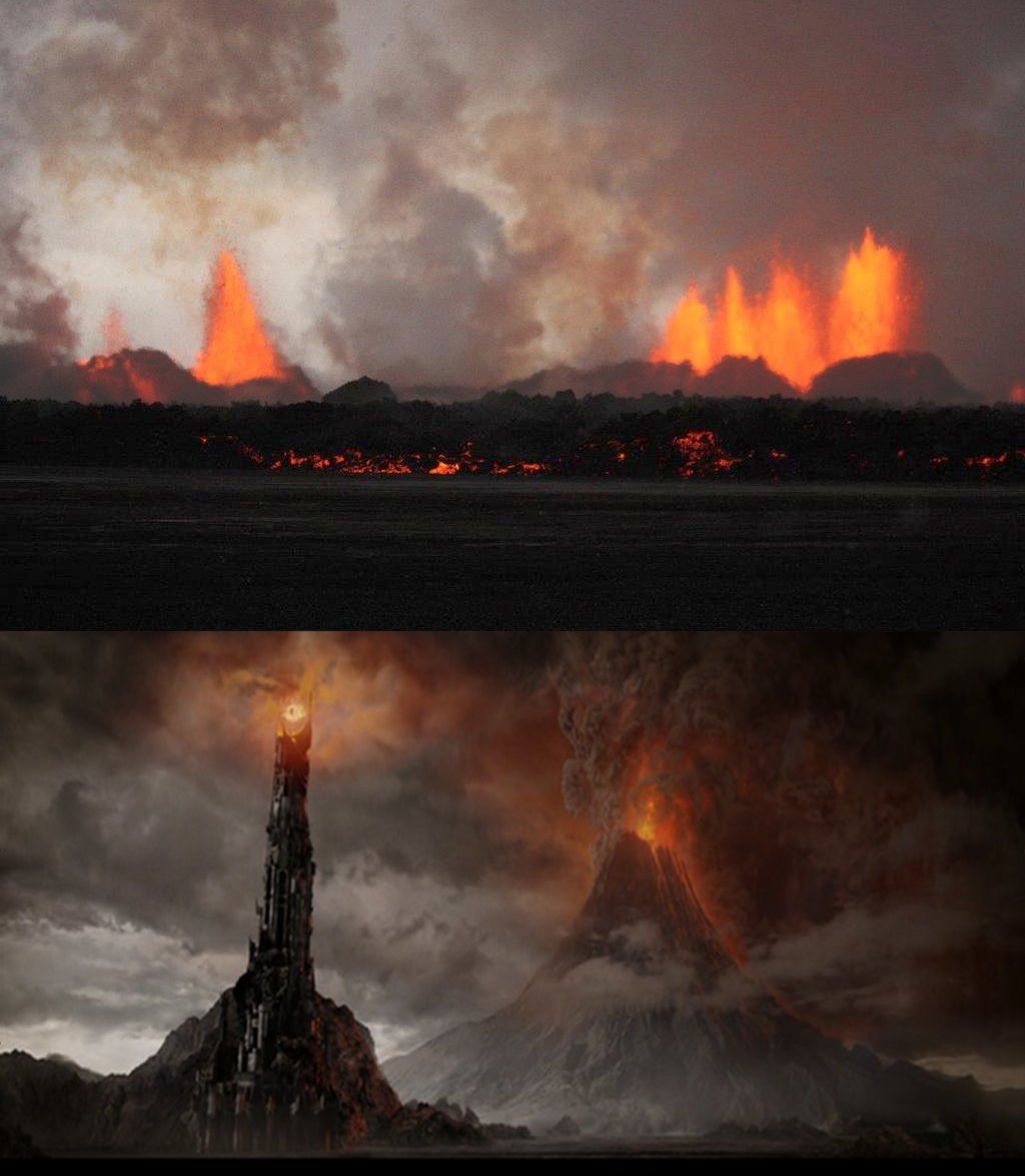
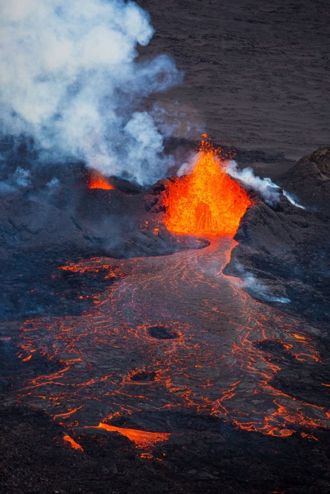
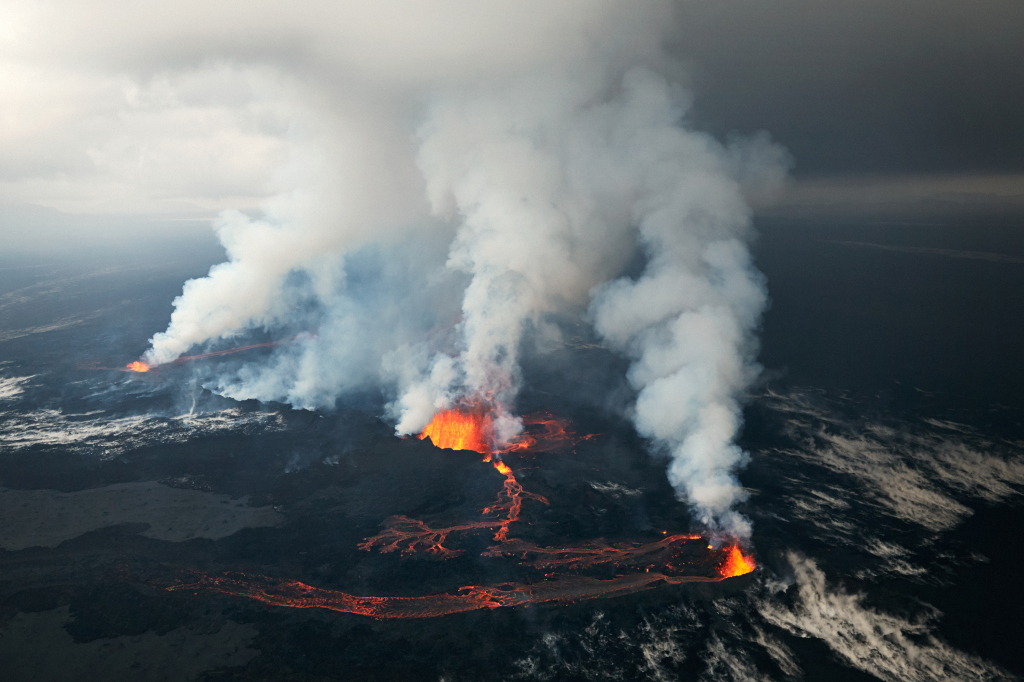
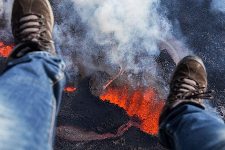
(Above: Top image, Mordor. Bottom image, Þorbjargarhraun. Wait a minute, that's backward. Or is it? Now I'm confused.)
First, let's start off with some bad news and some good news.
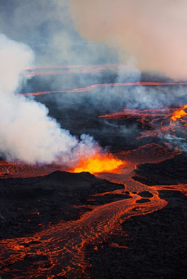
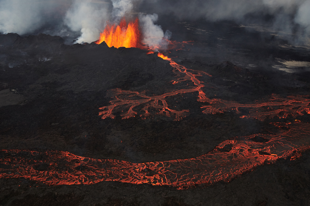
The bad news? Activity continues to grow. As mentioned in an update to the previous diaries, lava fountains have been around 120-130 meters tall all day, and there's extensive new rifting and subsidence in the site that could potentially lead to further eruptions. The fountains are still going strong right now.
But the good news? And I must say, one of the first bits of actually good news we've gotten thusfar? The rate of spreading shown on the GPS meters is slowing down.
Yeay! So it's all over and... wait... no it's not.
The spreading is the ultimate root of all of this. It thins and reduces the pressure on the crust, making melt easier. And it stresses the rock, to the point where it fractures, forming dikes like the one that caused this problem. But it does not govern all physics at hand here, and even a complete stop in spreading will not signal the end. Just like volcanoes can exist and erupt perfectly happily on places that aren't spreading centers, this eruption will continue until all forces in play have equalized. This means some combination of exhausting the pressure below and/or sufficient obstruction to the flow. Both of those are tall orders, given the great volume of magma below and the great degree to which the dike has opened up.
That said, it's definitely good news that, at least at present, the earth has slowed down its daily rate of making the problem worse.
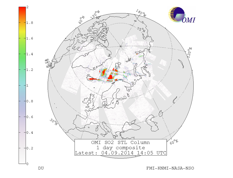
Active research into the gas continues unabated. Satellite gas measurements are reading sulfur dioxide from the plume at over six kilometers height Geographer Baldur Bergsson has the task of quantifying the emission rates, but this has not yet been done. For the first time it's being reported that on the first days scientists arrived to investigate the eruption, many were having bad poisoning symptoms. The situation is no longer as serious for two reasons: one, the further that scientists are working from the plumes (due to the ever-advancing lava flows), the less gas they're exposed to; and two, they're taking much greater precautions now. There are always gas meters active and everyone has gas masks (though as others have noted, they don't always wear them). It's also become standard to leave cars running so that they can rapidly evacuate an area if winds shift.
The police have observed people trying to sneak into the area and reiterated their warnings about the dangers and that it's a closed area. I'm not even sure that the word "sneak" is applicable when one was outright trying to land an aircraft near the eruption to let out passengers.
The gas is a local threat in the beginning, but that which leaves the surface can enter high-level wind currents and be lofted around the world. There's a gap in the satellite pass today, but you can roughly figure out what is in the missing area by what's on either sides of it:
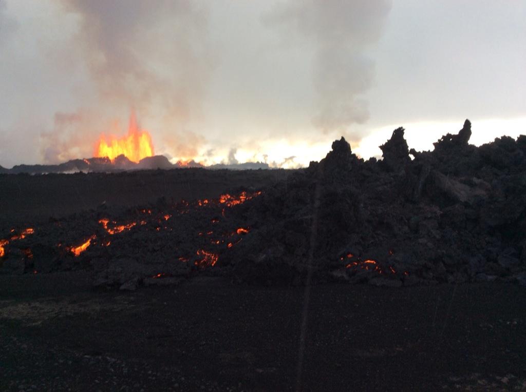
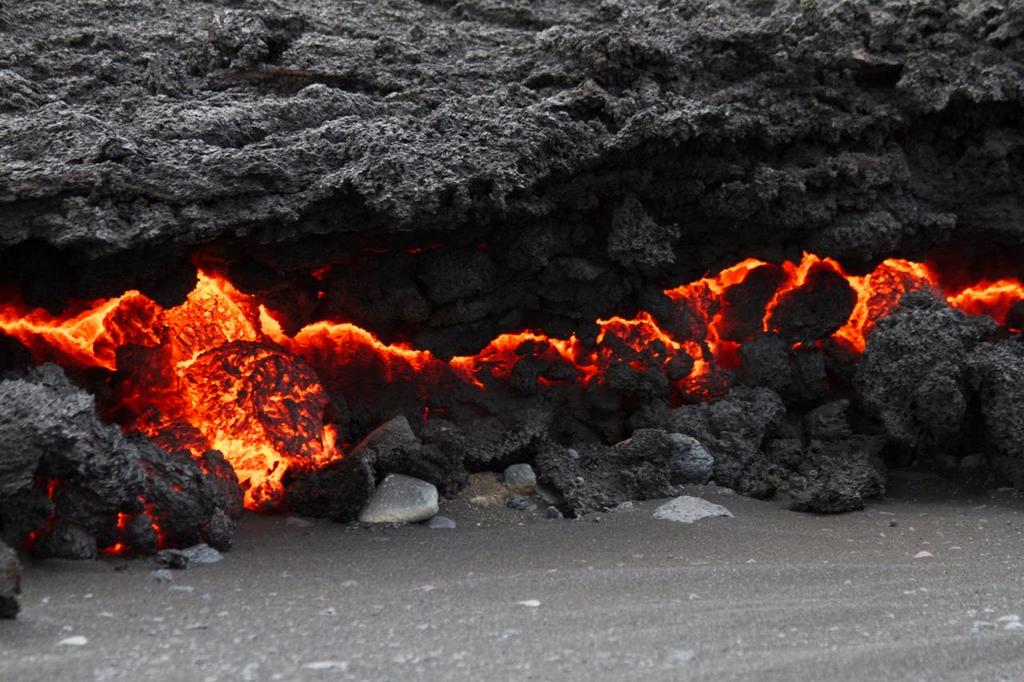
The dangers on-site are much more than just the gases. Chunks of cooling lava are being thrown hundreds of meters from the craters. One scientist nearly got trapped between a sudden flood and the advancing lava flow. Their "getaway vehicles" keep getting stuck in the wet sand. They're staying in the camping shelters near Askja for "safety", except that the pressure from the dike has destabilized the whole Askja system. The quakes there have made rocks on the edges of the canyon Drekagil unstable, and they regularly rain down. Part of their water system was hit by a large rock and smashed to pieces, leaving the scientists to have to collect water in buckets until they could get it replaced.
And of course, as always, the large quakes in the caldera continue.
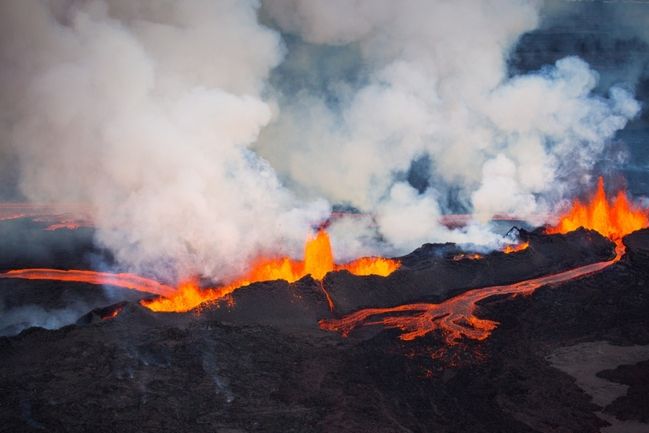
But enough of that. Time to watch the crust of the earth being born.
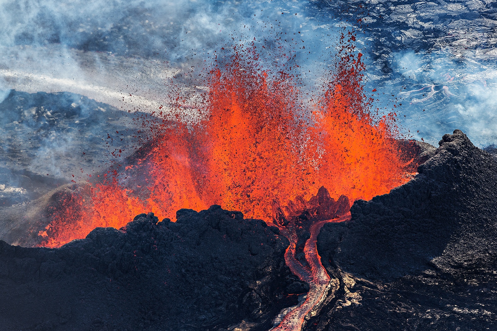
And videos. First, some basic views of lava fountains, and then a lava flow that's more "collapsing" its way forward than outright flowing.
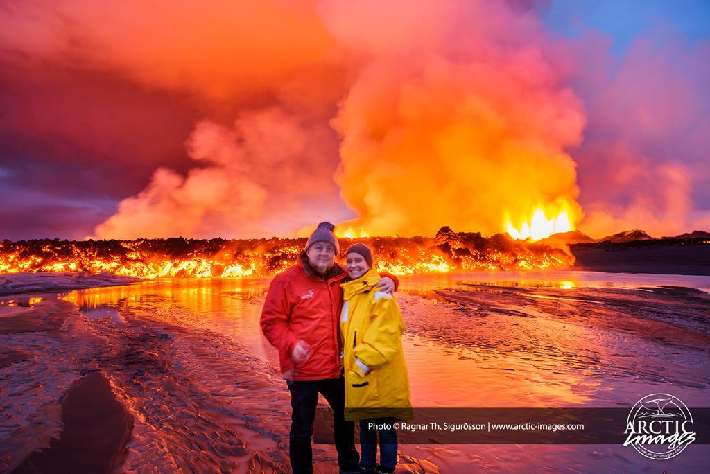
I find these evening views just immensely beautiful and serene:
And then the best aerial vid yet, with the perfect choice of music ("Brennisteinn" (Sulfur) by Sigur Rós):
Aren't you glad there's no ash so that there's no flight closures and we can get all of these beautiful shots? Yeah, yeah, no inhalation hazard, no millions of passenger delays, all of that is great and all, but what really matters here is the pretty pictures of the amazing power of nature!
Oh, and Míla is looking nice tonight:

Update, 8:30: Here we go again. Two new eruptive sites have opened up, halfway to the glacier, and they already have small lava fountains (not as tall as the others, which are reportedly still 120-130 meters, but still....). The scientists are banned from returning to the site until TF-SIF has assessed the situation and determined that there's no flood risk.
In totally unrelated news, a family on vacation in Iceland encouraged their son to dive naked into Flosagjá, a deep rift in Þingvellir full of crystal clear water. They apparently had forgotten what country they're in, as the water there is just barely above freezing and he nearly drowned before managing to cling precariously to a cliff.
Normally I wouldn't have mentioned this story here, except for what what the park ranger told the family afterwards:
"Afterwards I gave a good scolding to the family and let them know how dumb I thought that was and how they should all be candidates for the 2014 Darwin Awards. Then I wished them a safe trip and requested that they not try to grill marshmallows in the erupting volcano."
Update, 12:40: The
Met Office reports in the results of their survey flight. The most noteworthy details:
* GPS meters show a continuing decrease in motion, continuing the trend above
* The two new rifts are in the graben two kilometers north of the glacier. Their lava fountains are much smaller than those of the main eruption, but there's significant activity there, and their plume reaches to 15 thousand feet.
* There has been a small increase in the flow of the Jökulsár á Fjöllum.
* "A great deal of SO2 was measured around the eruption, like yesterday."
* The sigkatli over Dyngjujökull has deepened.
